WISE Radar data
Return to WISE-ISODYN Data Index Page
Radar data were collected using the PASIN radar echo sounding system (table 1 (Corr et al., 2007)). Data provided here includes picks of surface and ice sheet bed elevation. Full channel name definition is given in the table below. Note a single flight may contain data from two or more SEGY files, identified in the SEGYname channel. Surface elevation is derived from radar altimeter for ground clearance < 750 m, and the PASIN system for higher altitudes. A bedrock channel was created from the picked bed elevation, and surface elevation where flights crossed rock outcrops, as defined in the Antarctic Digital Database (http://www.add.scar.org/) Version 6, downloaded February 2014. A bedrock elevation channel including BEDMAP2 data (Fretwell et al., 2013), where there is no other information about ice sheet bed elevation, is also included.
Note in the database split by line the sections are defined as follows L= main survey grid lines, T=main survey grid lines, P=long transits, D=turns.
Download radio echo sounding data by flight
Download Geosoft database(479 MB) Download Ascii (140 MB)
Download radio echo sounding data by line
Download Geosoft database(272 MB) Download Ascii (140 MB)
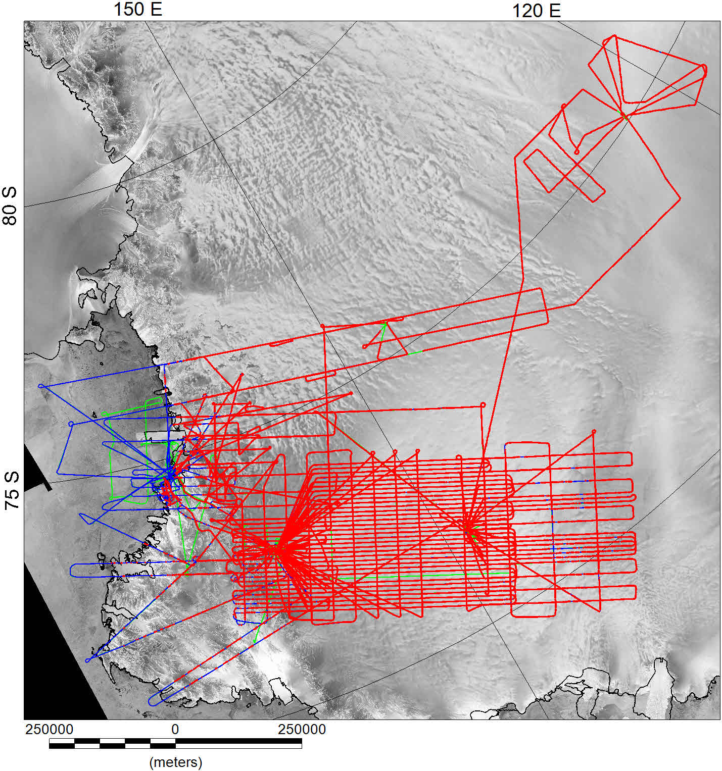
Radar data location. Red lines have both surface and bed picks. Blue line sections only have surface elevation picks. Green line sections have no radar data.
| Basic Channels | Name | Description |
|---|---|---|
| Date | UTC date (YYYY/MM/DD) | |
| Time | UTC time (HH:MM:SS.SS) | |
| FlightID | Sequential flight number and survey ID e.g. W12 | |
| Line_name | Line Number e.g. LW200.1 | |
| Lon | Longitude WGS 1984 | |
| Lat | Latitude WGS 1984 | |
| x | x projected meters, coordinate system defined on location page | |
| y | y projected meters, coordinate system, defined on location page | |
| Height_WGS1984 | Aircraft altitude (meters) in WGS 1984 |
| Radar | Name | Description |
|---|---|---|
| segy_name | Radar_segy file name | |
| TraceNum | Radar segy trace number | |
| PriNum | Raw radar time | |
| surfPickLoc | Location down trace of surface pick | |
| bedPickLoc | Location down trace of bed elevation pick | |
| surfElev | Surface elevation | |
| Picked_bedElev Ice bed elevation, derived by subtracting tice from surfElev | ||
| tIce | Ice thickness, derived from bedPickLoc and surfPickLoc. | |
| Bedrock | Rock elevation, from Picked_bedElev, or surfElev where there is rock outcrop. | |
| Mask | Flags regions with no Bedrock data within 2 km. | |
| Bedrock_and_BEDMAP2 | Rock elevation from our data, padded with BEDMAP2, used to create gridded bed elevation. |
References
Corr, H., Ferraccioli, F., Frearson, N., Jordan, T.A., Robinson, C., Armadillo, A., Caneva, G., Bozzo, E. & Tabacco, I.E., 2007. Airborne Radio-Echo Sounding of the Wilkes Subglacial Basin, the Transantarctic Mountains, and the Dome C Region. in The Italian–British Antarctic Geophysical and Geological Survey in Northern Victoria Land 2005–06—Towards the International Polar Year 2007–08., pp. 55-63, eds. Bozzo, E. & Ferraccioli, F. Terra Antartica Reports.
Fretwell, P., Pritchard, H.D., Vaughan, D.G., Bamber, J.L., Barrand, N.E., Bell, R., Bianchi, C., Bingham, R.G., Blankenship, D.D., Casassa, G., Catania, G., Callens, D., Conway, H., Cook, A.J., Corr, H.F.J., Damaske, D., Damm, V., Ferraccioli, F., Forsberg, R., Fujita, S., Gogineni, P., Griggs, J.A., Hindmarsh, R.C.A., Holmlund, P., Holt, J.W., Jacobel, R.W., Jenkins, A., Jokat, W., Jordan, T., King, E.C., Kohler, J., Krabill, W., Riger-Kusk, M., Langley, K.A., Leitchenkov, G., Leuschen, C., Luyendyk, B.P., Matsuoka, K., Nogi, Y., Nost, O.A., Popov, S.V., Rignot, E., Rippin, D.M., Riviera, A., Roberts, J., Ross, N., Siegert, M.J., Smith, A.M., Steinhage, D., Studinger, M., Sun, B., Tinto, B.K., Welch, B.C., Young, D.A., Xiangbin, C. & Zirizzotti, A., 2013. Bedmap2: improved ice bed, surface and thickness datasets for Antarctica, The Cryosphere, 7, 375–393, doi:310.5194/tc-5197-5375-2013.