WISE-ISODYN aeromagnetic data
Return to WISE-ISODYN Data Index Page
WISE-ISODYN aeromagnetic data presented in (Ferraccioli et al., 2009), further details on basic data acquisition are described in (Ferraccioli et al., 2007). The dataset available here includes all channels from raw through to levelled, and draped products. Channel naming follows SCAR/ADMAP2 data release protocols. Key data processing steps are described below, and a definition of all channels is in the table. Note in version 1 (V1) only data from the main high resolution grid are available.
Download airborne magnetic data
Download Geosoft database(513 MB) Download Ascii (148 MB)
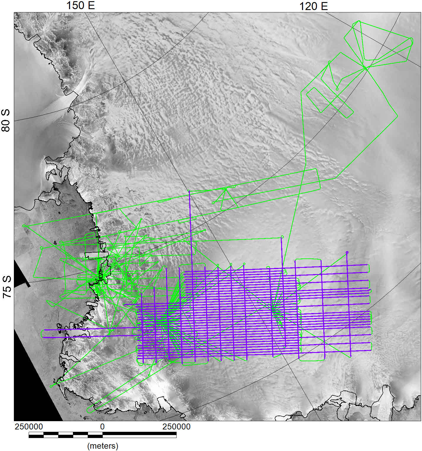
Location of aeromagnetic data. Purple lines show data over main survey grid available in release V1. Green lines show full survey.
Magnetic data channels and processing flow:
MagR- Raw magnetic total field intensity data (nT).
MagC- Compensated, or low pass filtered magnetic data. Adjustments to compensate for aircraft roll, pitch and yaw were applied (see Ferraccioli et al, 2007 for details). For this survey, both compensation, and low pass filtering of MagR were used.
RefField- Geomagnetic reference field value for which the magnetic data has been compensated. IGRF model 2005 as implemented in Geosoft (nT).
MagRTC- Compensated magnetic value adjusted for Tip tanks (where used) and geomagnetic reference field values. MagRTC= MagR- RefField.
BCorr- Low pass filtered (60 minute) magnetic base station correction.
MagBRTC- calculated as MagBRTC= MagRTC – Bcorr.
ACorr- Additional correction applied to compensate for heading errors.
MagF- Final mag value before levelling.
MagL- Statistically levelled mag data.
MagML- Microlevelled magnetic data following technique of (Ferraccioli et al., 1998). Note tie lines are not included in the microlevelled data channel.
MagML_Drape Microlevelled data draped to a uniform level of 2800m above the bed topography, using the method of (Pilkington and Thurston, 2001).
| Basic Channels | ||
|---|---|---|
| Line name | Line Number | |
| Flight ID | Sequential flight number | |
| x | x projected meters, coordinate system defined in readme | |
| y | y projected meters, coordinate system, defined in readme | |
| Lon | Longitude WGS 1984, | |
| Lat | Latitude WGS 1984, | |
| Height_WGS1984 | Aircraft altitude (meters) in WGS 1984, | |
| Date | Date of flight in time format e.g. 2006/01/08 | |
| Time | Time (UTC) of flight e.g. 23:52:42.0 |
| Mag processing channels | ||
|---|---|---|
| MagR | Raw mag data (nT) | |
| MagC | Raw mag data compensated for aircraft roll, pitch and yaw (nT) | |
| RefField | Geomagnetic reference field value (nT). IGRF/DGRF model info in readme. | |
| MagRTC | Compensated magnetic value following adjustments for RefField and tiptank events, if required (nT) | |
| Bcorr | Base station measured geomagnetic variations for which the data has been compensated (nT) | |
| MagBRTC | MagRTC- Bcorr | |
| Scorr | Any DC shift applied (nT). May be applicable to individual lines or entire dataset (e.g upward continuation) | |
| Acorr | Additional correction for variable flight heading, lag errors etc (nT) | |
| MagF | Final magnetic data value before levelling (nT) | |
| MagL | Statistically levelled magnetic data. Tie lines levelled to normal lines initially. | |
| MagML | Microlevelled magnetic data. Tie lines not included in MagML. | |
| MagML_Drape Microlevelled magnetic data draped at 2800m above sub-ice topography. |
References
Ferraccioli, F., Armadillo, A., Jordan, T.A., Bozzo, E. & Corr, H., 2009. Aeromagnetic exploration over the East Antarctic Ice Sheet: a new view of the Wilkes Subglacial Basin, Tectonophysics, 478, 62-77, doi:10.1016/j.tecto.2009.1003.1013.
Ferraccioli, F., Gambetta, M. & Bozzo, E., 1998. Microlevelling procedures applied to regional aeromagnetic data: an example from the Transantarctic Mountains (Antarctica), Geophysical Prospecting, 46, 177-196, DOI: 110.1046/j.1365-2478.1998.00080.x.
Ferraccioli, F., Jordan, T.A., Armadillo, A., Bozzo, E., Corr, H., Caneva, G., Robinson, C., Frearson, N. & Tabacco, I.E., 2007. Collaborative aerogeophysical campaign targets the Wilkes Subglacial Basin, the Transantarctic Mountains and the Dome C region. in The Italian–British Antarctic Geophysical and Geological Survey in Northern Victoria Land 2005–06—Towards the International Polar Year 2007–08., pp. 1-36, eds. Bozzo, E. & Ferraccioli, F. Terra Antartica Reports.
Pilkington, M. & Thurston, B.J., 2001. Draping corrections for aeromagnetic data: line versus grid-based approaches, Exploration Geophysics, 32, 95–101.