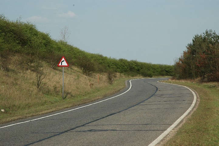
Madingley Slip Road - Protected Road Verge
S48
Protected Road Verge S48 - Madingley Slip
Road
 The County Council have over 90
protected road verges, which are designated because of their botanical
interest. They contribute to the Biodiversity Action Plan for
Cambridgeshire, which identifies roadside verges as important
sites of biodiversity. The protected verges are marked by prominent posts. Each
protected verge can have a designated warden to keep an eye on it. I am
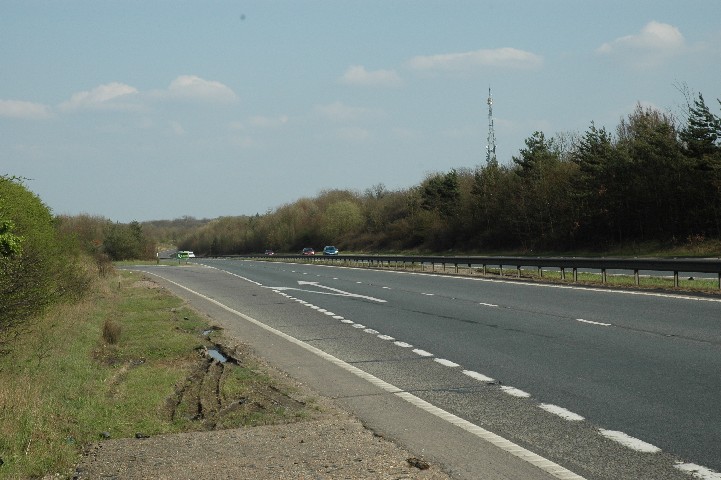
looking after S48, which is the
east bound slip road off the A428
leading to the
Madingley roundabout. The north protected verge runs from a concrete pad
just past the last exit sign for Cambridge to the start of the crash barrier on
the north side. The south protected verge runs from near the beginning of
the slip to the start of the crash barrier on the south side. It is just over a kilometre in length, and
averages a width of 6 metres, although parts of the southern verge approach a
width of 50 metres. The preliminary species list [Updated 2005
November 14] includes species from a 2002 WT survey. For completeness this
list also includes species seen in the area between the protected verge and the
north embankment of the A428 and in the cut-off between the slip road and Church
Lane and totals over 200 species.
The County Council have over 90
protected road verges, which are designated because of their botanical
interest. They contribute to the Biodiversity Action Plan for
Cambridgeshire, which identifies roadside verges as important
sites of biodiversity. The protected verges are marked by prominent posts. Each
protected verge can have a designated warden to keep an eye on it. I am
looking after S48, which is the
east bound slip road off the A428
leading to the
Madingley roundabout. The north protected verge runs from a concrete pad
just past the last exit sign for Cambridge to the start of the crash barrier on
the north side. The south protected verge runs from near the beginning of
the slip to the start of the crash barrier on the south side. It is just over a kilometre in length, and
averages a width of 6 metres, although parts of the southern verge approach a
width of 50 metres. The preliminary species list [Updated 2005
November 14] includes species from a 2002 WT survey. For completeness this
list also includes species seen in the area between the protected verge and the
north embankment of the A428 and in the cut-off between the slip road and Church
Lane and totals over 200 species.
Each protected verge has been surveyed by the Wildlife
Trust, with recommendations as to its management. The 2002 survey by the Wildlife Trust
for S48 notes:
Site description
 This verge is a good example of a calcareous species
rich verge with steep embankments and some anthills. The embankment on the
north side has been cut back to the chalk sub soil, whilst on the south side
there is a high chalk content in its topsoil. The predominant species
include False oatgrass (Arrhenatherum elatius), Upright brome (Bromus
erectus), Wild carrot (Daucus carota), Tufted hair grass (Deschampsia
cespitosa) and Yorkshire fog (Holcus lanatus).
This verge is a good example of a calcareous species
rich verge with steep embankments and some anthills. The embankment on the
north side has been cut back to the chalk sub soil, whilst on the south side
there is a high chalk content in its topsoil. The predominant species
include False oatgrass (Arrhenatherum elatius), Upright brome (Bromus
erectus), Wild carrot (Daucus carota), Tufted hair grass (Deschampsia
cespitosa) and Yorkshire fog (Holcus lanatus).
The whole verge has a good variety of species and thirteen calcareous to
neutral grassland indicators are present along the verge. Of these, seven strong grassland indicators
are present. Yellow wort (Blackstonia perfoliata), Upright brome, Wild basil (Clinopodium
vulgare) and Ploughman’s spikenard (Inula conyzae) are strong
indicators of calcareous grassland, whilst Glaucus sedge (Carex flacca),
Common spotted orchid (Dactylorhiza fuchsii) and Hairy violet (Viola
hirta) are all strong indicators of calcareous to neutral grassland.
Bee orchid (Ophrys apifera) is also frequent along the verge.
Due to the southern aspect and steep slope, the north side of the road
contains a high number of grassland indicators and grass species, thus allowing
much of the sward to remain open and retain a high population of species.
 Scrub is beginning to encroach out from the hedgerow, particularly where
Blackberry (Rubus fruticosus) and Dewberry (Rubus caesius) are dominant
along the northern verge. However Common spotted orchid and Hairy violet are partially
associated with dappled shade. The
number of Common spotted orchid associated with Yorkshire fog and Cocksfoot (Dactylis
glomerata) greatly increases on the southern side where the verge is damper.
Other very shady or damp patches also have abundant Common fleabane (Pulicaria
dysenterica), Field horsetail (Equisetum arvense) and Soft rush (Juncus
effusus).
Scrub is beginning to encroach out from the hedgerow, particularly where
Blackberry (Rubus fruticosus) and Dewberry (Rubus caesius) are dominant
along the northern verge. However Common spotted orchid and Hairy violet are partially
associated with dappled shade. The
number of Common spotted orchid associated with Yorkshire fog and Cocksfoot (Dactylis
glomerata) greatly increases on the southern side where the verge is damper.
Other very shady or damp patches also have abundant Common fleabane (Pulicaria
dysenterica), Field horsetail (Equisetum arvense) and Soft rush (Juncus
effusus).
Some tree species such as Field maple (Acer campestre)
have been planted along the verge and a hedgerow lines the verge on the northern
side.
Special interest
No scarce or rare species were recorded in the 2002 survey. The site is however a
proposed County Wildlife Site under the calcareous
grassland criteria. On 2005 May 30 I found one specimen of dwarf spurge (Euphorbia
exigua) on the north embankment, which is a recent addition to the red data
list. I also found a specimen growing on the A428 embankment in June,
and one on the south verge on August 13.
Management and recommendations
 The shallow slopes should be cut twice a year, once between
mid April to mid May, followed by a second cut in September/October.
The cuttings from the autumn cut should be removed to prevent a build up
of nutrients and deterioration in the quality of the grassland. To prevent
damage to the anthills a sensitive cutting regime should be implemented in these
areas using a strimmer.
The shallow slopes should be cut twice a year, once between
mid April to mid May, followed by a second cut in September/October.
The cuttings from the autumn cut should be removed to prevent a build up
of nutrients and deterioration in the quality of the grassland. To prevent
damage to the anthills a sensitive cutting regime should be implemented in these
areas using a strimmer.
Some scrub clearance should take place, but also a small
scattering of young scrub and trees should be maintained for the species that
are suited to these conditions.
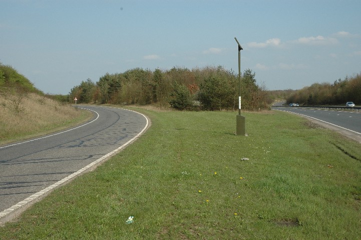
Four posts should be erected to mark the location of the
Protected Road Verge. [Two were put up, but these were not in the right position to mark the length of the
north verge. One is now correctly positioned following the drainage
works.]
Drainage improvements took place during 2006 May - July and the
contractors did an excellent job of protecting the verge. Soil imported as
fill along some sections of the non-protected verges is supporting several new
species. Scrub clearance is intended as part of the 'make good' during the
autumn of 2006.